Flooding
Floods are one of the most common hazards in the United States, however not all floods are alike. Some floods develop slowly, while others such as flash floods, can develop in just a few minutes and without visible signs of rain. Additionally, floods can be local, impacting a neighborhood or community, or very large, affecting entire river basins and multiple states.
Flash floods often have a dangerous wall of roaring water carrying rocks, mud and other debris. Overland flooding, the most common type of flooding, occurs when waterways such as rivers or streams overflow their banks as a result of rainwater and cause flooding. Floods can also occur when rainfall or snowmelt exceeds the capacity of underground pipes, or the capacity of streets and drains designed to carry flood water away from the City.
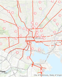
Be aware of flood hazards no matter where you live or work, but especially if you are in low-lying areas, near water, behind a levee or downstream from a dam. Even very small streams, gullies, creeks, culverts, dry streambeds or low-lying ground that appear harmless in dry weather can flood. Baltimore City has four major watersheds and receives both tidal and riverine flooding. This page is intended to assist all Baltimore City residents, business owners, and visitors in preparing for flood events.
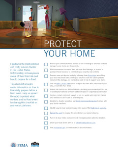
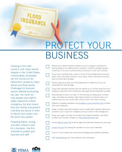
Here are resources for protecting your home or business from flooding:
- Department of Homeland Security – Federal Emergency Management Agency (FEMA)
- National Flood Insurance Program’s FloodSmart – Resources Page
- Protect Your Property From Flooding
- Above the Flood: Elevating your Floodprone House – FEMA-347
- Coastal Construction Manual – FEMA-P-55
- Homeowners – Flood Risk Resources – Maryland DFIRM Outreach Program
- Elevated Residential Structures – FEMA 54
- Protecting Manufactured Homes from Floods and Other Hazards – FEMA P-85
- Homeowners Guide to Retrofitting – FEMA P-312
- Benefits of Natural Floodplains – FEMA
- Floodproofing Non-Residential Structures (Full Document), FEMA P-936
- Flood Damage-Resistant Materials Requirements (Technical Bulletin 2)
- Protecting Building Utilities from Flood Damage – FEMA-348
- Reducing Damage from Localized Flooding – FEMA-511
- Selecting Appropriate Mitigation Measures for Floodprone Structures – FEMA-551
- National Flood Insurance Program – All FEMA Technical Bulletins
- Baltimore Department of Planning’s Fells Point Flood Mitigation Guidelines
To Prepare for a Flood You Should
Create an Emergency Plan (View on Ready.gov website)
Build an Emergency Kit (View on FEMA website)
Create a Family Communications Plan (View on Ready.gov website)
Avoid building in the floodplain
Elevate the furnace, hot water heater, and electrical panel in your home or business
Consider installing blackflow prevention devices to prevent flood water from backing up into the drains of your home
Know where your nearest evacuation route and emergency shelter. Click here for a map of Baltimore’s evacuation routes and emergency shelter locations.
 |
 |
 |
Flood Hazard Terms
Flood Watch – Flooding is possible. Tune in to NOAA Weather Radio, commercial radio or television for information.
Flash Flood Watch – Flash flooding is possible. Be prepared to move to higher ground; listen to NOAA Weather Radio, commercial radio or television for information.
Flood Warning – Flooding is occurring or will occur soon; if advised to evacuate, do so immediately.
Flash Flood Warning – A flash flood is occurring; seek higher ground immediately.
Causes of Flooding
Heavy Rains – Baltimore City is at heightened risk for flooding due to heavy rains produced from Nor’easters, Coastal Storms, and other heavy precipitation events. This excessive amount of rainfall can happen throughout the year, putting your property at risk.
Flash Floods – Flash floods are the #1 weather-related killer in the U.S. since they can roll boulders, tear out trees, and destroy buildings and bridges. A flash flood is a rapid flooding of low-lying areas in less than six hours, which is caused by intense rainfall from a thunderstorm or several thunderstorms. Flash floods can also occur from the collapse of a man-made structure.
Tropical Storms and Hurricanes – Hurricanes pack a triple punch: high winds, soaking rain, and flying debris. They can cause storm surges to coastal areas, as well as create heavy rainfall which in turn causes flooding hundreds of miles inland. While all coastal areas are at risk, Baltimore City is particularly vulnerable and could suffer severe losses due to storm surge as seen in 2003 from Hurricane Isabel. When hurricanes weaken into tropical storms, they generate rainfall and flooding that can be especially damaging since the rain collects in one place.
New Development – Construction and development can change the natural drainage and create brand new flood risks. That’s because new buildings, parking lots, and roads mean less land to absorb excess precipitation from heavy rains, hurricanes, and tropical storms.
Driving and Flooding
The following are important points to remember when driving in flood conditions:
Six inches of water will reach the bottom of most passenger cars causing loss of control and possible stalling
A foot of water will float many vehicles
Two feet of rushing water can carry away most vehicles including sport utility vehicles (SUV’s) and pick-ups
Do not attempt to drive through a flooded road. The depth of water is not always obvious. The road bed may be washed out under the water, and you could be stranded or trapped
Do not drive around a barricade. Barricades are there for your protection. Turn around and go the other way
Do not try to take short cuts. They may be blocked. Stick to designated evacuation routes
Be especially cautious driving at night when it is harder to recognize flood dangers
Additional Resources:
Financial Assistance Pre- and Post-Flood
FEMA’s Hazard Mitigation Assistance (HMA) grant programs provide funding for eligible mitigation activities that reduce disaster losses and protect life and property from future disaster damages. Currently, FEMA administers the following HMA grant programs:
Hazard Mitigation Grant Program (HMGP)– HMGP assists in implementing long-term hazard mitigation measures following Presidential disaster declaration
Pre-Disaster Mitigation (PDM)– PDM provides funds on an annual basis for hazard mitigation planning and the implementation of mitigation projects prior to a disaster.
Flood Mitigation Assistance (FMA)– FMA provides funds on an annual basis so that measures can be taken to reduce or eliminate risk of flood damage to buildings insured under the National Flood Insurance Program (NFIP).
FEMA’s HMA grants are provided to eligible applicants (states/tribes/territories) that, in turn, provide sub-grants to local governments and communities. The HMA grant programs provide funding opportunities for pre and post-disaster mitigation. While the statutory origins of the programs differ, all share the common goal of reducing the risk of loss of life and property due to natural hazards.
Water Levels in City Streams and Bay
The U.S. Geological Survey (USGS) and the City’s Department of Public Works maintain a variety of stream gauges across the city and one tidal gauge to track water levels and help forecast flood events. The USGS gauge information is available to the public and can be accesses through the National Water Dashboard.
Stream Gauges
- GWYNNS FALLS AT WASHINGTON BLVD AT BALTIMORE, MD
- GWYNNS FALLS AT VILLA NOVA, MD
- DEAD RUN AT FRANKLINTOWN, MD
- JONES FALLS AT SORRENTO, MD
- WEST BRANCH AT HERRING RUN AT IDLEWYLDE, MD
- MOORES RUN TRIB. NEAR TODD AVE AT BALTIMORE, MD
- MOORES RUN AT RADECKE AVE AT BALTIMORE, MD
- HERRING RUN AT SINCLAIR LANE AT BALTIMORE, MD

