

Baltimore Floodplain Management Program
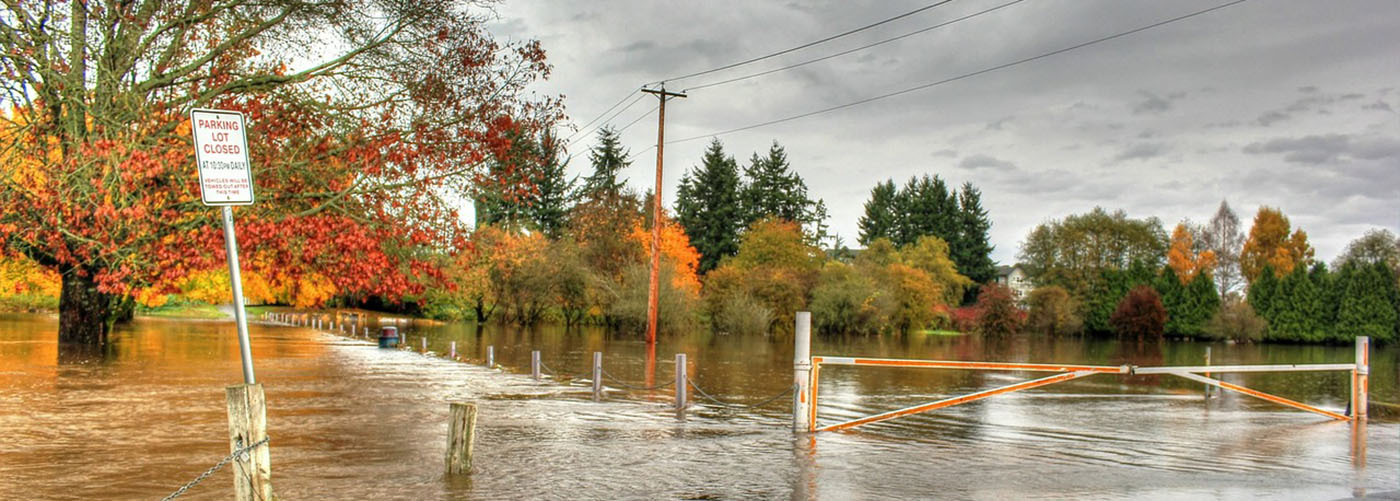
Baltimore City is built at the mouth of the Patapsco River, which empties directly into the Chesapeake Bay. Presently, the City’s regulated floodplain is 5,136 acres and contains over 2,800 buildings. Baltimore City floodplain management is a program of corrective and preventative measures for reducing flood damage, including but not limited to emergency preparedness plans, flood control works, and floodplain management regulations. Floodplain regulations are meant to protect life, health and property; minimize rescue and relief efforts; minimize business interruptions; minimize damage to public facilities; minimize the occurrence of future flood blight areas; minimize public expenditures for costly flood control projects; and prevent increases in the regional flooding.
There are four main categories for the Baltimore City Floodplain Management Office. Click on the header for additional information about each of the categories listed below.
I. Floodplain Management Program
National Flood Insurance Program (NFIP)
Baltimore City Floodplain Code – Article 7 Division I
Baltimore City Floodplain Maps – CoDeMap
Baltimore City Floodplain Permits
II. Flood Insurance
Flood Insurance through FloodSmart.gov
Maryland State Insurance Administration – Flood Insurance Information
Mandatory Purchase Requirements
Types of Coverage
III. Flood Preparedness: Protecting Yourself and Your Property
Preparing for a Flood
Causes of Flooding
Flood Hazard Terms
Driving and Flooding
IV. Floodplain Forms and Additional Information
Baltimore City Floodplain Forms
FEMA Floodplain Forms and Library
FEMA Fact Sheets
Floodsmart Video Library
Baltimore City Certified Floodplain Managers (CFM’s)
The City of Baltimore Floodplain Management Office provides map information services, flood protection information, flood protection assistance, and historical hazard information. The Office offers information about Baltimore City’s FIRMs such as assistance with determining if a property is located in the Special Flood Hazard Area, what the estimate Base Flood Elevation (BFE) is for a property, and what flood depths may be at that site. Floodplain Managers will also provide information about historic flooding, V-zones, the floodway, and natural floodplain functions in a specific area. They also maintain elevation certificates , floodproofing certificates and other relevant floodplain information. These documents are readily available to anyone upon request.
Baltimore City CFM’s provide these additional services:
Information from the Flood Insurance Rate Maps (FIRM’s) that is needed to help write a flood insurance policy
Assistance in how to use CoDeMap and other online Flood Map Resources
Information about mandatory flood insurance purchase requirement
Historical flood information and flood hazard information
Documents, brochures and information sheets on flooding, floodplain management and preparedness
Information about natural floodplain functions and areas designated as open space for floodplain purposes such as floodways
Information on flood studies, FIRM’s, LiMWA lines, map revisions, map amendments and any other floodplain changes
Preparedness and Flood Protection Assistance Information
Site Visits upon request
For assistance with flood maps please contact Joanna Birch, CFM at Joanna.Birch@baltimorecity.gov
Terms to know
Floodplain– Simply put, a floodplain is any land area susceptible to being inundated by water from any source. It includes the floodway and flood-fringe areas.
Flooding– A general and temporary condition of partial or complete inundation of normally dry land areas from the overflow of inland or tidal waters, the unusual and rapid accumulation or runoff of surface waters from any source, or mudflows which are proximately caused by flooding.
Base Flood Elevation (BFE)– The Base Flood Elevation is a computed elevation to which floodwater is anticipated to rise during the base flood. The base flood means a flood that has a 1% chance of being equaled or exceeded in any given year.
Design Flood Elevation (DFE)– The Design Flood Elevation refers to an elevation of 2 feet above the 0.2% annual chance of flood in the tidal floodplain and 2 feet above the 1% annual chance of flood in the non-tidal floodplain. The elevation of the lowest floor of a building must be at or above the design flood elevation.
Freeboard- An additional amount of height above the Base Flood Elevation (BFE) used as a factor of safety (e.g., 2 feet above the BFE) in determining the level at which a structure’s lowest floor must be elevated or floodproofed to be in accordance with State or community floodplain management regulations.
Flood Protection Elevation (FPE)– The Flood Protection Elevation refers to an elevation of 2 feet above the 0.2% annual chance of flood in the tidal floodplain and 2 feet above the 1% annual chance of flood elevation in the non-tidal floodplain . The elevation of the lowest floor of a dwelling must be at or above the flood protection elevation. The FPE is also called the Design Flood Elevation (DFE).
Floodproofing– Flood proofing includes a variety of construction methods, such as watertight doors, windows, walls, and bulkheads, which can be used to prevent flood waters from entering a structure. This method of flood protection, called “dry” flood proofing is not a sure deterrent to flooding and is used only in very special circumstances where it may not be possible to elevate a building or accessory structure. Local floodplain regulations restrict dry flood proofing to non-residential structures. “Wet” flood proofing, which involves intentional internal flooding of areas constructed of flood resistant materials, may be allowed for minor additions to structures and certain accessory structures that constitute a minimal investment. Furthermore, state and federal floodplain management standards require all flood proofed structures to be designed and certified by a registered engineer. The City of Baltimore uses ASCE-24, Flood Resistant Design and Construction for all floodproofing.
Frequently Asked Questions
Q: Who can I contact to find out more information about obtaining a flood insurance policy and determining my flood risks?
FloodSmart.gov is the official site of the National Flood Insurance Program and provides individuals with the resources to determine their flood risk and find agents that serve their area. Visit the following website and enter your address for more information.
Q: Where can I find flood hazard information and flood rate maps for my property?
The FEMA Flood Map Service Center (MSC) is the official public source for flood hazard information produced in support of the National Flood Insurance Program (NFIP). You can use the MSC to find your official flood map, access a range of other flood hazard products, and take advantage of tools for better understanding flood risk. https://msc.fema.gov/portal
Q: Will my flood insurance policy cover broken pipes or main breaks?
No. Flood insurance will only cover damage from broken pipes or main breaks if the breakage causes the general condition of flooding in the area and the flood is the proximate cause of the sewer or drain backup, sump pump discharge or overflow, or seepage of water.